Sunday, June 23, 2019

Mary Magdalene


In our current timeline - one wonders if Mary Magdalene was the wife of Jesus - and had a daughter with him named, Sarah - thus perpetuating the bloodline.
Mary Magdalene was the most important woman disciple in the movement of Jesus. Tradition has labeled her a prostitute, but there is nothing in the Bible to support this view and much to dispute it.
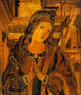
Mary Magdalene, which probably means "Mary of Magdala", a town on the western shore of the Lake of Tiberias, is described in the New Testament as a follower of Jesus both in the canon and in the apocrypha. Nothing is known about her outside of Scripture. Her feast day is July 22.
Mary Magdalene in the canon
For part of her story, Catholics and Protestants agree: She is mentioned in Luke 8:3 as one of the women who "ministered to Christ of their substance". Their motive, according to the author of Luke was that of gratitude for deliverances he had wrought for them: Luke tells that out of Mary were cast seven demons, in an exorcism. These women accompanied him also on his last journey to Jerusalem (Matt. 27:55; Mark 15:41; Luke 23:55). They were witnesses to the Crucifixion.
There Mary remained until all was over, and the body was taken down and laid in a tomb prepared for Joseph of Arimathea. Again, in the earliest dawn of the first day of the week she, with Salome and Mary the mother of James, (Matt. 28:1; Mark 16:2); Peter 12), came to the sepulchre, bringing with them sweet spices, that they might anoint the body of Jesus. They found the sepulchre empty but saw the "vision of angels" (Matt 28:5). As the first witness to the Resurrection, Mary Magdalene hastened to tell Peter and another - unknown - apostle, (John 20:1, 2), (gaining her the epithet "apostle to the apostles") and again immediately returned to the sepulchre.
There she lingered thoughtfully, weeping at the door of the tomb. The risen Lord appeared to her, but at first she knew him not. His utterance of her name "Mary" recalled her to consciousness, and she uttered the joyful, reverent cry, "Rabboni". She would fain have clung to him, but he forbade her: "17 Jesus said to her, 'Do not cling to Me, for I have not yet ascended to My Father; but go to My brethren and say to them, "I am ascending to My Father and your Father, and to My God and your God."'"
This is the last entry in the canonic New Testament regarding Mary of Magdala, who now returned to Jerusalem.
The Gospel of Mary
Further attestation of Mary of Magdala and her role among some early Christians is provided by the apocryphal Gospel of Mary Magdalene. which survives in two 3rd century Greek fragments and a longer 5th century translation into Coptic. Tellingly, in the Gospel the testimony of a woman first needed to be defended. All of these manuscripts were first discovered and published between 1938 and 1983, but as early as the 3rd century there are Patristic references to the Gospel of Mary. These writings reveal the degree to which the gospel was despised and dismissed by the early church fathers. In the fragmentary text, the disciples ask questions of the risen Savior (a designation that dates the original no earlier than the 2nd century) and are answered.
Then they grieve, saying, "How shall we go to the Gentiles and preach the Gospel of the Kingdom of the Son of Man? If even he was not spared, how shall we be spared?" And Mary Magdalene bids them take heart: "Let us rather praise his greatness, for he prepared us and made us into men." She then delivers - at Peter's request - a vision of the Savior she has had, and reports her discourse with him, which shows Gnostic influences.
Her vision does not meet with universal approval:
    "But Andrew answered and said to the brethren, 'Say what you think concerning what she said. For I do not believe that the Savior said this. For certainly these teachings are of other ideas." "Peter also opposed her in regard to these matters and asked them about the Savior. "Did he then speak secretly with a woman, in preference to us, and not openly? Are we to turn back and all listen to her? Did he prefer her to us?"
Karen King has observed, "The confrontation of Mary with Peter, a scenario also found in The Gospel of Thomas, Pistis Sophia, and The Gospel of the Egyptians, reflects some of the tensions in second-century Christianity. Peter and Andrew represent orthodox positions that deny the validity of esoteric revelation and reject the authority of women to teach."
Expansion of the Mary Magdalene tradition
Tradition as early as the 3rd century identified as Mary Magdalene the woman who was a sinner in Luke 7:36-50:"
    37 And, behold, a woman in the city, which was a sinner, when she knew that Jesus sat at meat in the Pharisee's house, brought an alabaster box of ointment, 38 And stood at his feet behind him weeping, and began to wash his feet with tears, and did wipe them with the hairs of her head, and kissed his feet, and anointed them with the ointment."
Though there is no connection made in the New Testament, nor is the woman in the house of the Pharisee given a name, the idea that Mary was "the woman who was a sinner", or that she was unchaste, was developed by the Patristic writers of the 3rd and 4th centuries. This idea is rejected by most Protestants. Catholics, on the other hand, consider this one person to be, not only the sinner of Luke 7:36-50 but also Mary of Bethany, the sister of Martha and the resurrected Lazarus (Luke 10:38-42 and John 1:10); although the Roman Catholic Church withdrew from this linkage at the Second Vatican Council (1969) it survives strongly in folk Catholicism.
For some Christians, the idea developed by Church fathers, that Mary is also the woman that Jesus had rescued from being stoned to death (as recounted in the Pericope Adulterae) still holds true. However those critical scholars who are drawing conclusions from the canonic texts alone believe that the woman Jesus rescued and Mary were two separate persons. Conservative early-19th century theological traditions, vividly realized in the Mel Gibson movie The Passion of the Christ, portray the prostitute and Mary as the same person, and Martin Scorsese's earlier film adaptation of Nikos Kazantzakis's novel The Last Temptation of Christ followed a similar tradition.
Veneration of Mary Magdalene
As a Roman Catholic saint, Mary Magdalene's relics were venerated at Saint Maximin la Sainte Baume, Provence, and attracted such throngs of pilgrims that the great Basilica was erected there from the mid thirteenth century, one of the finest Gothic churches in the south of France. Though her bones were scattered at the French Revolution, her head is said to remain in her shrine in a cave at La Sainte-Baume near Marseille, although another medieval tradition holds that she died in Ephesus and was buried in Constantinople.
The Magdalene became a symbol of repentance for the vanities of the world, and Mary Magdalene was the patron of Magdalene College, Cambridge (pronounced "maudlin", as in weepy penitents). Unfortunately her name was also used for the infamous Magdalen Asylums in Ireland where supposedly fallen women were treated as slaves.
Wife of Jesus?
Some modern writers, notably the authors of the 1982 Holy Blood, Holy Grail (2003) and Dan Brown in the novel The Da Vinci Code (2003), hold that:


  • Mary Magdalene was in fact the wife of Jesus, and
  • that fact was omitted by Pauline Christian revisionists and editors of the Gospels. These writers cite non-canonical and Gnostic writings in selective portions to support their argument. While sources like the Gospel of Philip depict Mary Magdalene as being closer to Jesus than any other disciple, there is no ancient document which claims she was his wife. It is thought the meaning here is Mary Magdalene knew what Jesus was talking about. She understood him, while the disciples did not.
    An argument for support of this speculation is that bachelorhood was very rare for Jewish males of Jesus' time, being generally regarded as a transgression of the first mitzvah (divine commandment) - "Be fruitful and multiply". It would have been unthinkable for an adult, unmarried Jew to travel about teaching as a rabbi, as Jesus certainly did.
    A counter-argument to this is that the Judaism of Jesus' time was very diverse and the role of the rabbi was not yet well defined. Celibate teachers like John the Baptist were known in the communities of the Essenes, and Paul of Tarsus was an example of an unmarried itinerant teacher among the Christians, at a time when most Christians were still practicing Jews. It was really not until after the Roman destruction of the Second Temple in A.D. 70 that Rabbinic Judaism became dominant and the role of the rabbi made uniform in Jewish communities.
    Mary Magdalene appears with more frequency than other women in the canonical Gospels and is shown as being a close follower of Jesus. Mary's presence at the Crucifixion and Jesus's tomb, while hardly conclusive, is at least consonant with the role of grieving wife and widow, although if that were the case Jesus might have been expected to make provision for her care as well as for his mother Mary. Given the lack of contemporary documentation, this scenario cannot be proven, and although some consider the idea desirable to believe, most scholars do not take it seriously.
    Metaphysical marriage
    Other reasoning would say that Christ was already married‹ to the Church‹ an image that was developed first by Paul in what became the New Testament and then later expanded on by the Church fathers. Some writers, following an early tradition that Jesus is in a mystical sense the second Adam (again beginning with Paul and continuing with Irenaeus and others), embody this sense with literal parallels: like the first Adam, his bride was taken from his side when he had fallen asleep (died on the cross). In medieval Christian anagogic exegesis, the blood and water which came from his side when he was pierced, was held to represent the bringing forth of the Church with its analogy in the water of baptism and the wine of the new covenant. Thus Christ can be said to already have a wife in the Church; and so it would not be considered possible or tolerable to believe that he was otherwise married.
    The Urantia Book (1955) maintains that Jesus was not married to Mary or any other woman. According to its account, he refused an offer of marriage at age eighteen because he was dedicated to his "Father's business" ("If I am a son of destiny, I must not assume obligations of lifelong duration until such a time as my destiny shall be made manifest"), but gained parental experience by becoming the sole supporter and father-figure to his siblings after Joseph died.

  • Some people link Mary to the Holy Grail and the Knights Templar. Secular books with names such as Holy Blood, Holy Grail and The Woman With the Alabaster Jar expand on traditions that she committed sexual sins. They claim that Jesus married her and fathered one or more children. These books are based on fiction, not fact. below is quoted information from that text.
    In popular Christian tradition Mary Magdalene is a prostitute who finds redemption by apprenticing herself to Jesus. And she figures most noticeably in the Fourth Gospel, where she is the first person to behold Jesus after the Resurrection. In consequence she is extolled as a saint, especially in France - where, according to medieval legends, she is said to have brought the Holy Grail.
    The Magdalene is not, at any point in any of the Gospels, said to be a prostitute. When she is first mentioned in the Gospel of Luke, she is described as a woman 'out of whom went seven devils'. It is generally assumed that this phrase refers to a species of exorcism on Jesus' part, implying the Magdalene was possessed. But the phrase may equally refer to some sort of conversion and/or ritual initiation.
    The cult of Ishtar or Astarte - the Mother Goddess and 'Queen of Heaven' - involved, or example, a seven-stage initiation [the seven veils]. Prior to her affiliation with Jesus, the Magdalene may well have been associated with such a cult. Migdal, or Magdala, was the 'Village of Doves', and there is some evidence that sacrificial doves were in fact bred there. And the dove was the sacred symbol of Astarte.
    - Baigent, Leigh & Lincoln, The Holy Blood and the Holy Grail
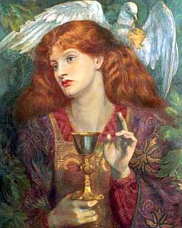
    In some versions of history, Magdalene is viewed as the mother of the Merovingian Dynasty. Mary Magdalene was the redeemed sinner who was the first to see Christ after his Resurrection. Through her redemption from sin and her unique knowledge of the Risen Christ, she was regarded by the occult initiates of the Middle Ages as a medium of secret revelation. Those initiates had chosen the planet Venus as her symbol in the cosmos.
    - Henry Lincoln, The Holy Place
    Long ago her name was Isis, Queen of the benevolent springs, Come to me all you who labour and are heavy laden, and I will give your the rest.. Others knew her as Magdalene with the celebrated vase full of healing balm. The initiated know her to be Notre Dame Des Cross.
    - Le Serpent Rouge
    Mary Magdalene had her surname of Magdala, a castle, and was born of right noble lineage and parents, which were descended of the lineage of kings. And her father was named Cyrus, and her mother Eucharis. She with her brother Lazarus, and her sister Martha, possessed the castle of Magdalo, which is two miles from Nazareth, and Bethany, the castle which is nigh to Jerusalem, and also a great part of Jerusalem, which, all these things they departed among them.
    - Legenda Aurea (published in Genoa in 1275)
    She was also high priestess of the Temple of Ishtar at Magdala, and as such she would have been the keeper of the doves. She is linked with Benjamite, the tribe which was ostracized because they were of the line of Cain. So too was Hiram Abiff, architect of the Temple of Solomon.
    - David Wood, Genesis
    The idea that Mary [Jesus' mother] had been an adultress never completely disappeared in Christian mythology. Instead, the character of Mary was split into two: Mary the mother of Jesus, believed to be a virgin, and Mary Magdalene, believed to be a woman of ill repute.
    The idea that the character of Mary Magdalene is also derived from Miriam the mythical mother of Yeishu, is corroborated by the fact that the strange name 'Magdalene' clearly resembles the Aramaic term 'mgadla nshaya' meaning 'women's hairdresser'. Because the Christians did not know what the name 'Magdalene' meant, they later conjectured that it meant that she had come from a place called Magdala on the west of Lake Kinneret. The idea of the two Marys fitted in well with the pagan way of thinking. The image of Jesus being followed by the two Marys is strongly reminiscent of Dionysus being followed by Demeter and Persephone.
    - Hayyim ben Yehoshua, The Myth of the Historical Jesus

    Monday, April 29, 2013

    New Evidence Unearthed for the Origins of the Maya


    Civilizations rise and fall, often in dramatic fashion. Their origins, though, are subtler and tend to be overlooked or poorly understood. In the case of the Maya, a new paper in Science magazine sheds surprising light on that murky early period. The classic period of the lowland Maya in Mesoamerica (A.D. 300 to 950) is a popular topic in archaeology, but little is known about the early preclassic era (before 1000 B.C.). Scientists are typically split between two theories on the subject: Either the Maya developed directly from an older "mother culture" known as the Olmec, or they sprang into existence independently. Takeshi Inomata, professor of anthropology at the University of Arizona and a National Geographic research grantee, disagrees with both theories. In his work at the archaeological site of Ceibal in Guatemala, he has unearthed evidence for a more complex origin story. Early Ritual Spaces The Maya are usually associated with monumental architecture. Massive pyramids and immense plazas testify to a complex and fascinating culture. One can hardly hear the word "Maya" without imagining elaborately decorated kings and priests climbing the long, steep stairs of pyramids like those at Tikal. But pyramids don't just spring out of the jungle overnight, nor does a complex culture merely appear. Inomata and his team dug below the monumental architecture at Ceibal to see how such structures began. Inomata assumed that the now iconic classic architecture probably stood on earlier sites used for similar purposes. His assumption turned out to be correct. He found smaller platforms built of earth beneath the pyramids of stone, signaling a formal ritual complex at Ceibal dating to around 1000 B.C. The presence of ritual architecture early in the development of the Maya is an indication of a settled lifestyle with complex agriculture, religion, and a stratified society—all of which add up to a unified culture and the beginnings of a larger civilization. Redefining the Olmec Connection Experts have traditionally believed that when the Olmec were busy building their civilization at large sites such as La Venta, near the Gulf coast in modern Mexico, the people who would become the Maya were living in loosely associated nomadic groups in the jungles to the east and southeast. This theory holds that the Maya derived their entire society—including their architecture and social structure—directly from the Olmec. But Inomata's work has revealed that the Olmec is not an older civilization. In fact, Ceibal pre-dates La Venta by as long as two centuries. And although some Olmec cities are indeed older than both La Venta and Ceibal, they likely did not interact with the Maya. "This does not mean that the Maya developed independently," Inomata says. Instead, he believes, the influence flowed both ways. La Venta and Ceibal appear to have developed in tandem in a great cultural shift throughout the region. "It seems more likely that there was a broad history of interactions across these regions, and through these interactions, a new form of society developed." More Flexible Definitions To further complicate matters, Inomata stresses that the evidence doesn't show clear distinctions between the Olmec and Maya at the preclassic stage. The two civilizations are easy to differentiate during the classic period, since the Maya had by then developed a distinct language and culture. But the period between 1000 and 700 B.C. is more transitional. With La Venta and Ceibal freely trading ideas, technologies, cultural elements, and perhaps even population, it's difficult to call one Olmec and the other Maya. "Determining labels for these early people is quite a tricky question—we're not sure if residents of early Ceibal were wholly Mayan," says Inomata. "We have decided to take a much more flexible approach, avoiding fixed labels in favor of looking at patterns of interaction and how more stable identities developed." An Agricultural Revolution Inomata and his team will spend the next three years analyzing the findings from Ceibal. They will then begin to excavate outside the site's center, hoping to gain an understanding of what day-to-day life was like in the preclassic period. The peripheral areas, separated from the ritual plazas and temples, could hold more keys to the origins of the Maya. Inomata believes that the residential and agricultural areas are particularly important. Around 1000 B.C. the previously nomadic groups that became the Maya began to build urban ritual areas. "Instead of starting with villages," Inomata says, "they made a ceremonial center." The idea for that may have come from the people who later created La Venta. A radical shift in agriculture at that time may also have played an important role in the move to a more settled lifestyle. Corn, the principal crop of the Maya, "became much more productive," says Inomata. "And then it made sense to cut down forests and increase agriculture." Inomata believes this agricultural revolution may have been rooted in genetic changes in the corn plant itself. But this, like so many other ideas about the rise and fall of the Maya civilization, still requires much more evidence to prove

    Tuesday, May 5, 2009

    Band of Holes near Pisco Valley, Peru

    Thousands of man-sized holes are carved into the barren rock near Pisco Valley, Peru on a plain called Cajamarquilla.

    These strange holes, stretching for a mile over uneven mountain terrain, were here for so long that the local people have no idea who made them, or why. Funny thing is no one really saw the big picture until the area was seen from the air.


    Archeologists have speculated they were dug to store grain in. Two problems with this, say the folks thinking out of the box: there were a lot easier ways to create storage containers than the hard work and decades it must have taken to chip out all of these, and it would have made more sense, if these were to store grain, to build several huge chambers.

    Ok, said the archeologists. Perhaps they were used as one-person tombs? Vertical graves of some sort? But no bones, artifacts, scraps, inscriptions, jewelry...not even a tooth or strand of hair has been found in them. They have no covers to seal them as you might a tomb and no sacred history or even myth was passed down to label them as such.

    Some sections have holes in rigid and perfect precision; some run in rows that curve up in arches, some staggered lines. They vary in depth to about 6-7 feet deep yet some are merely shallow indents as if not completed - though surrounded by those that are.

    To date, no one has a clue why they're here, who made them or what they were.

    Satellite photo of the "Band of Holes" near Pisco Valley.
    Note: The location of the band of holes is highlighted brown.

    Even von Daniken's work begins to take on a realness when one finds an old National Geographic from 1933 corroborating the "Band of Holes," that he personally inspected a few years ago. Each hole is a meter wide and just as deep. There are eight holes spanning 24 meters in width, marching in repetitive uniform fashion, from the Pisco Valley rolling over a mile through mountain terrain -- finally disappearing in the misty mass of Peru. These holes remind this old West Texas boy of the traces left by a massive drilling rig moving along methodically, testing the geology of the Andes for precious metals. Lasers have also left such tracings in the ground. Archaeologists say they represented defensive positions or graves for the ancient ones, except why would you bury anyone on a slope in rocky soil at more than a 45-degree angle?

    If you look at the most northern part of the band, you will notice that it ends within unnaturally darkened area (it almost looks like a remnants of an explosion)... see the photo below:

    Strangely dark area where the "band of holes" ends.


    Few miles east from the band, satellite photo shows structures that look like a remnants of an ancient settlement (these formations do not look natural and there is nothing similar in the entire area):

    Remnants of an ancient city?

    For the reference here is satellite photo of Machu Picchu:

    Chichén Itzá

    Chichén Itzá, Mexico (Latitude 20°40'N | Longitude 88°32'W)

    Chichén-Itzá is the most visited archaeological site in the peninsula of Yucatan, due to its extraordinary architecture beauty and its geographical location. It is located 120 km from Merida (about midway between the towns of Cancun and Merida) in the State of Yucatan, Mexico.

    Location of Chichen Itza in Yucatan Peninsula, Mexico

    Layout of the ruins of Chichen Itza

    The site was developed between the 6th and 14th centuries. The early inhabitants (A.D. 600-900) were the Itzá, a Maya group. Chichén Itzá seems to have been abandoned during the 10th century but later resettled around A.D. 1000. The second group of settlers may have been the original Itzá, Toltecs from Tula (near Mexico City), or a fusion of both groups.

    Archaeologists have recognized both Maya and Toltec influences in the architecture: most believe that the Toltecs influenced the Itzá, but some argue that the influence was in the other direction.

    It was founded in the year 514 of our era by the priest LAKIN CHAN who was also called Itzamna. This is why their people were called since the foundation, chanes or itzaes.

    The name Chichén Itzá, is derived from the Mayan language: "Chi" - mouth, "Chen" - well and "Itza" - the tribe that inhabited the area. When the Spaniards arrived to Chichen - Itza, it had been abandoned as a consequence of the civil war fought with Mayapan. In between 1196 and 1441 the final collapse of this culture took place in the north of the peninsula.

    The conquerors found the buildings of Chichén Itzá, partially in ruins and their names and real use were unknown; this is why the present names are suppositions.


    Cather's drawings of El Castillo

    El Castillo (old photo)

    About 60% of El Castillo pyramid has been restored almost fully from the decaying condition in which it was re-discovered by John L. Stephens in 1841 although the eastern and southern faces are still partially eroded by the forces of time and erosion. There are no plans to restore these two faces of the pyramid as those that restored the other portions wish for future generations to see the condition in which it was originally discovered.

    El Caracol (old photo)

    Drawings of the Nunnery

    Artist's rendering of central Chichen Itza around the year AD 1,000. View is from the north with the Castillo Pyramid in the center, Temple of the Warriors to the east, and a sacbe to the Sacred Cenote in the foreground.

    Chichen Itza is the most impressive and intact ruins of Mayan civilization that the modern world has. This now popular tourist attraction is located on the Yucatan Peninsula of Mexico and has fast become the best restored record of the spiritual, domestic, and agricultural lives of these people. Mayan ruins in central America, such as Chichen Itza, are remnants of cities that were abandoned long before Columbus reached the area; yet this culture has influenced many areas of architecture, art, and astronomy, that live on even in our modern world.

    The Mayan people are most famous for their brilliant and advanced astronomical knowledge and their resiliency. Stone remnants of their civilization are currently being preserved at various sites in Mexico; in Tilkal, Guatemala; in Altun Ha, Belize; and in Copan, Honduras. Mayan civilization spread from their origin on the Yucatan Peninsula to the rain forests of Mexico eastward and the other surrounding countries. Today, mostly on the Yucatan Peninsula and in the state of Chiapas, Mayan culture is still thriving with four to six million people, over 30 languages, and many ethnic backgrounds represented. Modern Mayans still continue many of the traditions of their ancient culture, such as speaking their ancient dialects instead of Spanish, growing their traditional crops (corn, beans, chile, tomatoes, and squash) with the same techniques, and using herbal medicinal treatments instead of modern medicine. Many spiritual aspects of Mayan life, the purpose for their ancient cities, is still exercised with many offerings and pilgrimages to modern churches, sometimes fusing Catholicism with Mayan beliefs from antiquity.

    Around 550 AD, Mayans settled Chichen (translated "the mouth of the well") around two wells; one sacred and one "profane," used for everyday use. These underground wells and subsequent waterways, known as "cenotes", were the lifeblood of the community. Chichen Itza was primarily a rain forest area settled on flat, porous limestone that rain seeped through to became trapped in the insolvent bedrock below. These cenotes were, therefore, the oasis of the society, full of rain and run off water for their living needs. Chichen Itza, like most Mayan centers, was primarily a spiritual, ceremonial site instead of a commercial area. The loose arrangement of decentralized farming communities came together for offerings, sacrifices, and ceremonies in the town. Some trade, education, and recreation were also performed there. Exhumed from the sacred well were many ceremonial objects, skulls, and entire skeletons.

    Evidence suggests that Chichen Itza was abandoned by the Mayans in the tenth century. This is concurrent with evidence of all Mayan cities being abandoned around this period. The abandonment has not yet been fully explained. The Mayans returned to and resettled their cities around 1000 AD. Chichen Itza's architecture is seen to have two distinctive styles; traditional Mayan architecture, and more recent Toltec architecture. The Toltecs were another more warlike tribe who invaded Chichen Itza around the year 800 AD. The Toltecs were much more fierce than the Mayans and human sacrifice was a large part of their rituals. It is quite easy to decipher which structures in Chichen Itza were built before and after 800 AD.

    Sunday, May 3, 2009

    Sacsayhuaman (Saqsaywaman)

    This site is located north of the city of Cusco, at an altitude of about 3555 meters above sea level, between the districts of Cusco and San Sebastian, both of them within in the province and department of Cusco. The archaeological park covers an area of 3094 Hectares and contains more than 200 archaeological sites. Leading to Saqsaywaman there are two paved roads, one starts in the old and traditional neighbourhood of San Cristobal and is about 1.5 kilometers long and the other road begins at Avenida Collasuyo and is 4 kilometers long.

    When the Spanish conquerors arrived first to these lands; they could not explain themselves how Peruvian "Indians" (ignorant, wild, without any ability of logical reasoning, one more animal species according to conquerors) could have built such a greatness. Their religious fanaticism led them to believe that all that was simply work of demons or malign spirits. Still today, many people believe in the inability of ancient Quechuas to create such a wonder, so they suggest that they were made by beings of some other worlds, extraterrestrial beings with superior technology that made all that possible. However, our history and archaeology demonstrate that those objects of admiration are an undeniable work of the Incas, Quechuas, Andean people or however pre-Hispanic inhabitants of this corner of the world would be named.

    The imperial city Cusco, meaning ‘navel of the earth,’ was laid out in the form of a puma, the animal that symbolized the Inca dynasty. The belly of the puma was the main plaza, the river Tullumayo formed its spine, and the hill of Sacsayhuaman its head.

    One of the most imposing architectonic complexes inherited from the Incan Society is Sacsayhuaman, which because of several of its qualities is considered as one of the best monuments that mankind built on the earth's surface.

    The wall or rampart is the most impressive section, built with enormous carved limestone boulders, this construction has a broken line that faces to the main plaza called Chuquipampa which is a slope with 25 angles and 60 walls.The biggest carved boulder of the first wall weighs about 70 tons and like all of the other rocks was brought from a quarry called Sisicancha, three kilometers away and where there are still rocks that were transported part of the way. Each wall is made up of 10 fronts with the most important ones known as Rumipunco, tiupunku, Achuanpunku and Viracocha punku.

    Three walls of Sacsayhuaman - the teeth of the Puma's Head

    Originally there were three "walls" or "bulwarks" which foundations are still seen today; they are the most spectacular remains of that fabulous building that according to chroniclers did not have any comparison in the old world. They are three parallel walls built in different levels with lime-stones of enormous sizes; zigzagging walls that because of their appearance it is suggested that they represent the "teeth" of the puma's head that the complex represented. The boulders used for the first or lower levels are the biggest; there is one that is 8.5 m high (28 ft.) and weights about 140 metric tons. Those boulders classify the walls as being of cyclopean or megalithic architecture. Some authors believe that the three walls represent the three levels of the Andean Religious World: beginning from the bottom would be the Ukju Pacha (underground stage), the Kay Pacha (earth's surface stage) in the middle, and the Hanan Pacha (sky stage) on the top. Besides; those levels are identified with their three sacred animals: the Amaru or Mach'aqway (snake), the Puma (Cougar or Mountain Lion), and the Kuntur (Andean condor). Because of the zigzagging shape of the walls, some authors suggest that they represented the Illapa god (thunder, lightning and thunderbolt). It is possible that all the previous elements related to their religion would not be excluding, because there are divine interactions, and as it is known "three" was a key number among Quechuas.

    There are no other walls like these. They are different from Stonehenge, different from the Pyramids of the Egyptians and the Maya, different from any of the other ancient monolithic stone-works.

    The stones fit so perfectly that no blade of grass or steel can slide between them. There is no mortar. They often join in complex and irregular surfaces that would appear to be a nightmare for the stonemason.

    Scientists speculate that the masonry process might have worked like this: after carving the desired shape out of the first boulder and fitting it in place, the masons would somehow suspend the second boulder on scaffolding next to the first one. They would then have to trace out a pattern on the second boulder in order to plan the appropriate jigsaw shape that would fit the two together. In order to make a precise copy of the first boulder's edges, the masons might have used a straight stick with a hanging plum- bob to trace its edges and mark off exact points for carving on the second boulder. After tracing out the pattern, they would sculpt the stone into shape, pounding it with hand-sized stones to get the general shape before using finger-size stones for precision sanding. Admittedly, this entire technique is merely scientific speculation. The method might have worked in practice but that doesn't mean this is how the ancient Quechua stonemasons did it.

    There is usually neither adornment nor inscription. There is Elfin whimsy here, as well as raw, primitive and mighty expression. Most of these walls are found around Cusco and the Urubamba River Valley in the Peruvian Andes. There a few scattered examples elsewhere in the Andes, but almost nowhere else on Earth.
    Mostly, the structures are beyond our ken. The how, why and what simply baffle. Modern man can neither explain nor duplicate. Mysteries like this bring out explanations scholarly, whimsical, inventive and ridiculous.

    What is left from the three walls is made with lime-stones that in this case were used just in order to built the bases or foundations. The main walls were made with andesites that are blackish igneous stones which quarries are in Waqoto on the mountains north of San Jeronimo, or in Rumiqolqa about 35 Kms. (22 miles) from the city. Limestones are found in the surroundings of Sacsayhuaman but they are softer and can not be finely carved as the andesites of the main walls that were of the "Sedimentary or Imperial Incan" type. Destruction of Sacsayhuaman lasted about 400 years; since 1536 when Manko Inka began the war against Spaniards and sheltered himself in this complex. Later the first conquerors started using its stones to built their houses in the city; subsequently the city's Church Council ordered in 1559 to take the andesites for the construction of the Cathedral. Even until 1930, Qosqo's neighbours just paying a small fee could take the amount of stones they wanted in order to build their houses in the city: four centuries of destruction using this complex as a quarry by the colonial city's stone masons.

    Sacsayhuaman was supposedly completed around 1508. Depending on who you listen to, it took a crew of 20,000 to 30,000 men working for 60 years.
    Here is a mystery:
    The chronicler Garcilaso de la Vega was born around 1530, and raised in the shadow of these walls. And yet he seems not to have had a clue as to how Sacsayhuaman was built. He wrote:

    "....this fortress surpasses the constructions known as the seven wonders of the world. For in the case of a long broad wall like that of Babylon, or the colossus of Rhodes, or the pyramids of Egypt, or the other monuments, one can see clearly how they were executed...how, by summoning an immense body of workers and accumulating more and more material day by day and year by year, they overcame all difficulties by employing human effort over a long period. But it is indeed beyond the power of imagination to understand now these Indians, unacquainted with devices, engines, and implements, could have cut, dressed, raised, and lowered great rocks, more like lumps of hills than building stones, and set them so exactly in their places. For this reason, and because the Indians were so familiar with demons, the work is attributed to enchantment."

    Surely a few of those 20,000 labourers were still around when Garcilaso was young. Was everyone struck with amnesia? Or is Sacsayhuaman much older than we've been led to believe?

    Archaeologists tell us that the walls of Sacsayhuaman rose ten feet higher than their remnants. That additional ten feet of stones supplied the building materials for the cathedrals and "casas" of the conquistadors.
    It is generally conceded that these stones were much smaller than those megalithic monsters that remain.
    Perhaps the upper part of the walls, constructed of small, regularly-shaped stones was the only part of Sacsayhuaman that was built by the Incas and "finished in 1508." This could explain why no one at the time of the conquest seemed to know how those mighty walls were built.


    Muyuqmarka

    Garcilaso wrote that on the top of the three "walls" or "bulwarks" there were three strong towers disposed in a triangle. The main tower was in the middle and had a circular shape, it was named as Moyoc Marca (Muyuq Marka), the second one was named as Paucar Marca, and the third Sacllar Marca (Sallaq Marka); the last two ones were rectangular.

    This is the remaining base of a tower discovered in 1934 at the top of the Temple of Sacsayhuaman. The Muyuqmarka consists of three concentric, circular stone walls connected by a series of radial walls. There are three channels constructed to bring water into what many scientists consider to be a reservoir. A web-like pattern of 34 lines intersects at the center and also there is a pattern of concentric circles that corresponded to the location of the circular walls.


    Cusco

    According to Indian legend, Cusco was so barren that no crops could be grown there. In what is now the center of the city, there was a lake and a bog. The second Inca, Sinchi Roca, had the swamp drained and filled with stones and logs until it was firm enough to support their stone buildings. He also had thousands of loads of good earth brought in and spread over the land, making the valley fertile. What could possibly have been the attraction of this barren, boggy place? Suppose the magnificent lower walls of Sacsayhuaman were there before Manco Capac came to Cusco. That in itself would be enough to make the place holy.

    The imperial city Cusco, meaning ‘navel of the earth,’ was laid out in the form of a puma, the animal that symbolized the Inca dynasty. The belly of the puma was the main plaza, the river Tullumayo formed its spine, and the hill of Sacsayhuaman its head. According to one early Spanish chronicler, the Inca emperor Pachakuti, who had made a pilgrimage to the ancient holy city of Tiahuanaco, sought to emulate the building perfection he had seen there in the construction of Cusco’s temples. Cusco, however, was not really a city in the European sense of the word. Rather it was an enormous sacred artifact, the dwelling place of the families of the Inca nobility (common people were not allowed entrance to the ceremonial nexus), and the center of the Inca cosmos.


    Coricancha

    In Cusco too, was the most important temple in the Inca empire, the Coricancha (meaning literally, "the corral of gold"). Dedicated primarily to Viracocha, the creator god, and Inti, the Sun god, the Coricancha also had subsidiary shrines to the Moon, Venus, the Pleiades, and various weather deities. Additionally there were a large number of religious icons of conquered peoples which had been brought to Cusco, partly in homage and partly as hostage. Reports by the first Spanish who entered Cusco tell that ceremonies were conducted around the clock at the Coricancha and that its opulence was fabulous beyond belief.

    Coricancha - Inca Sun Temple. Finest of Inca stonework.

    Golden Enclosure in Coricancha sheltered
    INTI Sun God & Gold Disk (1430-1532).

    The wonderfully carved granite walls of the temple were covered with more than 700 sheets of pure gold, weighing around two kilograms each; the spacious courtyard was filled with life-size sculptures of animals and a field of corn, all fashioned from pure gold; the floors of the temple were themselves covered in solid gold; and facing the rising sun was a massive golden image of the sun encrusted with emeralds and other precious stones. (All of this golden artwork was quickly stolen and melted down by the Spaniards, who then built a church of Santo Domingo on foundations of the temple.)

    The Coricancha (sometimes spelled Qoricancha) was also the centerpiece of a vast astronomical observatory and calendrical device for precisely calculating precessional movement. Emanating from the temple were forty lines called seques, running arrow-straight for hundreds of miles to significant celestial points on the horizon. Four of these seques represented the four intercardinal roads to the four quarters of Tawantinsuyu, others pointed to the equinox and solstice points, and still others to the heliacal rise positions of different stars and constellations highly important to the Inca.

    Rodadero Hill and the Throne of the Incas

    In the outskirts of Cusco, exactly opposite to Sacsayhuaman is Rodadero, a giant rock hill with numerous stairwells and benches carved into the rock

    Throne of the Inca

    The rock is smooth and rounded, like it was polished by a glacier.

    Rodadero hill is made up of diorite rock of igneous origin, where you can find waterways, carved rocks and what has been revealed to be the so-called throne of the Incas that is accessed by a series of precisely carved stairs. Behind this section there are small labyrinths, tunnels and vaulted niches in the walls.

    Ollantaytambo

    At the northern end of the Sacred Valley, Ollantaytambo is rare if not unique in Peru.
    Ollantaytambo is a massive citadel located 50 kilometers from Machu Picchu. The citadel served as both a temple and a fortress. At some time unknown, and for reasons unknown, work mysteriously stopped on this huge project.


    Inca terraces (left) and megalithic wall (right) at pre-Inca site of Ollantaytambo.


    Mysterious Pre-Inca megalithic stonework at Ollantaytambo

    Stone Technology

    The Sun Temple (above) that was constructed with huge red porphyry (pink granite) boulders. The stone quarry is named Kachiqhata (Salt Slope) and is located about 4 km (2.5 miles) away on the other side of the valley, by the upper side of the opposite south-western mountains. The boulders were carved partially in the quarries, and taken down to the valley's bottomIn order to cross the river Quechuas constructed an artificial channel parallel to the natural river bed that served for deviating the river's water according to conveniences. Therefore, while that water flowed through one channel the other was dry, thus stones could be taken to the other side of the valley. More over, the boulders were transported to the upper spot where the temple is erected using the inclined plane that is something like a road which silhouette is clearly seen from the valley's bottom. They had the help of log rollers or rolling stones as wheels, South-American cameloids' leather ropes, levers, pulleys, and the power of hundreds and even thousands of men. Today, on the way from the quarry to the temple there are dozens of enormous stones that people know as " tired stones" because it is believed that they could never be transported to their destination; those stones are the reason why some authors claim that the Sun Temple was unfinished when the Spanish invasion happened.

    Massive, multi-sided blocks were precisely fitted together in interlocking
    patterns in order to withstand the disastrous effects of earth quakes.

    Scientists speculate that the masonry process might have worked like this: after carving the desired shape out of the first boulder and fitting it in place, the masons would somehow suspend the second boulder on scaffolding next to the first one. They would then have to trace out a pattern on the second boulder in order to plan the appropriate jigsaw shape that would fit the two together. In order to make a precise copy of the first boulder's edges, the masons might have used a straight stick with a hanging plum-bob to trace its edges and mark off exact points for carving on the second boulder. After tracing out the pattern, they would sculpt the stone into shape, pounding it with hand-sized stones to get the general shape before using finger-size stones for precision sanding. Admittedly, this entire technique is merely scientific speculation. The method might have worked in practice but that doesn't mean this is how the ancient Quechua stonemasons did it.

    "How were such titanic blocks of stone brought to the top of the mountain from the quarries many miles away? How were they cut and fitted? How were they raised and put in place? Now one knows, no one can even guess. There are archaeologists, scientists, who would have us believe that the dense, hard andesite rock was cut, surfaced and faced by means of stone or bronze tools. Such an explanation is so utterly preposterous that it is not even worthy of serious consideration. No one ever has found anywhere any stone tool or implement that would cut or chip the andesite, and no bronze ever made will make any impression upon it."

    A. Hyatt & Ruth Verrill ----America's Ancient Civilizations

    Jean-Pierre Protzen thinks the Verrills was wrong. He went to Cuzco and showed how river rocks could be used as hammers to pound stones into the desired shape.

    "It appears that the Inca technique of fitting the blocks together was based largely on trial and error. It is a laborious method, particularly if one considers the size of some of the huge stones at Sacsahuaman or Ollantaytambo. What should be kept in mind, however, is that time and labour power were probably of little concern to the Incas, who did not have a European notion of time and had plenty of tribute labour from conquered peoples at their disposal."

    Jean-Pierre Protzen ---Scientific American ---Feb. 1986

    Was this monolith carved with stone tools?


    Aramu Muru

    Another similar in nature megalithic structure is Aramu Muru near the Lake Titicaca.

    Lake Titicaca, on the borders of Peru and Bolivia, is where Inca legends say life on Earth was first created by Viracocha. In the center of the lake is the Island of the Sun, with an ancient, sacred temple. Nearby is Sillustani, where mysterious burial towers called chulpas were once plated with gold and held the remains of Inca royalty.

    A few miles away is Aramu Muru’s Portal, a doorway-shaped niche in a stone outcropping, located in a region known as the Valley of the Spirits. The local villagers who walked with us refused to come close to the portal. They tell stories about people disappearing through the solid rock.


    Mysterious giant stone sculpture of Aramu Muru, north of Chucuito, Peru


    Teotihuacan

    Teotihuacan means 'The City of the Gods", or "Where Men Become Gods"
    (in Nahuatl). It is located in the valley of the same name 30 miles north of Mexico City.

    Teotihuacan used to be a thriving city and ceremonial center that predated the Aztecs by several centuries. Most likely it was Mexico's biggest ancient city at its peak and the sixth largest city in the world in AD 600.

    Teotihuacan began declining sharply around 650 AD, and was almost completely abandoned around 750 AD. No one knows why.

    At its peak around 500-600 A.D., Teotihuacan contained perhaps 200,000 people. It was a well planned city covering nearly eight square miles and larger and more advanced than any European city of the time. Its civilization was contemporary with that of ancient Rome , and lasted longer - more than 500 years.

    Though archaeologists have long been fascinated with the site, Teotihuacan's culture and history are still largely mysterious. The civilization left massive ruins, but no trace has yet been found of a writing system and very little is known for sure about its inhabitants, who were succeeded first by the Toltecs and then by the Aztecs.
    The Aztecs did not live in the city, but gave the place and its major structures their current names. They considered it the "Place of the Gods" - a place where, they believed, the current world was created.

    Mysterious Layout of Teotihuacán

    The city of Teotihuacán is meticulously laid out on a grid which is offset 15º.5 from the cardinal points. Its main avenue, the "Street of the Dead," runs from 15º.5 east of north to 15º.5 west of south, while its most impressive structure, the Pyramid of the Sun, is directly oriented to a point 15º.5 north of west -- the position at which the sun sets on August 13.

    There is one very peculiar thing about the city of Teotihuacan;
    It is oriented 15.5 degrees east of True North!*

    • 100 BC - 0 AD Proto-Teotihuacan (two small hamlets in northern pocket of Valley of Mexico, population = 5000)
    • 0 BC - 150 AD Teotihuacan I - (Avenue of the Dead, Pyramid of the Sun established)
    • 150 AD - 300 AD Teotihuacan II - (Grid pattern established)
    • 300 AD - 650 AD Teotihuacan III - (Pinacle of development, population = 85,000-200,000)
    • 650 AD - 750 AD Teotihuacan IV - Decline and fall

    Besides the major ceremonial pyramids, there were also palaces and temples, especially near the north end of the city surrounding the plaza in front of the Pyramid of the Moon. These included the Palace of Quetzalcoatl, the Butterfly Palace, the Temple of the Feathered Conches, and the Palace of the Jaguars. The sophistication and artistry of the Teotihuacanos can be seen everywhere in the magnificent murals and stone carvings which adorn the walls of the palaces and apartment compounds.

    The city met its end around 700 AD through deliberate destruction and burning by the hand of unknown invaders. Although a century earlier, around AD 600, almost all of Teotihuacan's influence over the rest of Mesoamerica had ceased, indicating some sort of internal malaise or decline before the destruction.

    The first strains appeared about AD 650. A century later, Teotihuacan was a shadow of its former self. The population had declined so rapidly that the once-proud city was now little more than a series of hamlets extending over an area of about a square kilometer.

    Some great catastrophe apparently struck the city in AD 700, reducing its population to below 70,000. Many of its people moved eastward. The city was deliberately burnt and destroyed. Over the years, its buildings collapsed and the pyramids became overgrown with dense vegetation.

    Teotihuacan's decline was almost as rapid as its rise to prominence. Even so, eight centuries later, Teotihuacan was still revered far and wide as an intensely sacred place. But no one remembered who had built it or that tens of thousands of people had once lived there.

    Away from the Avenue of the Dead, the city continued to live on for another two centuries, although the population of Teotihuacan sunk to only a quarter of its former total. Some sort of crisis overtook all the Classic civilizations of Mesoamerica (including the Maya) two centuries later, forcing them to abandon most of the cities. Some anthropologists believe the crisis may have been a lessening of the food supply caused by a drying out of the land and a loss of water sources to the area.

    They speculate that this might have been brought about by a combination of natural climactic shift towards aridness that appears to have happened all over Mexico during the Classic period and the residents having cut all the timber in the valley. Originally there were cedar, cypress, pine, and oak forests; today there are cactus, yucca, agave, and California pepper trees. This change in vegetation indicates a big climate shift.

    Although Teotihuacan presents a puzzle to archaeologists because it was a huge city that appears to have arisen without antecedents, the single most important fact which archaeologists have learned about the Classic period in Mexico was the supremacy of Teotihuacan. As the urbanized center of Mexico, with high population and tremendous production, its power was imposed through political and cultural means not only in its native highland habitat, but also along the tropical coasts, reaching even into the Maya area. It's trading and tribute empire was comparable with the Aztec empire that eventually followed it. All other Mexican states were partly or entirely dependent upon it for whatever achievements they attained.

    When Teotihuacan fell, around 650 AD, the unifying force in Mesoamerica was gone, and with it widespread inter-regional trade. The Late Classic period saw increasing fractionalization among cultures. In the place of great states, petty kingdoms and militarism arose. From the highpoint of civilization at Teotihuacan, wars became the rule of the day, and for those unfortunate enough to be captured, sacrifice to the gods. Military empires, such as the Toltecs in the twelfth century AD (and later the Aztecs, starting in fourteenth century AD), which grew up from these warring factions were the cultures met by the Spanish in 1519 and largely eradicated by 1521.

    Probably the reason that the Spanish were able to conquer the Aztecs in such a short amount of time had less to do with their skill as soldiers and more to do with the fact that the Spaniards physically resembled the descriptions in Aztec legends of the god Quetzalcoatl.

    Quetzalcoatl, while symbolized as a feathered serpent, appears also to have been an historic figure - the man credited with bringing civilization, learning, culture, the calendar, mathematics, metallurgy, astronomy, masonry, architecture, productive agriculture, knowledge of the healing properties of plants, law, crafts, the arts, and peace to the native people. He is pictured as a quite different physical type than the natives - fair skinned and ruddy complexioned, long nosed, and with a long beard. He was said to have arrived by boat from the east, and sailed off again years later promising to return someday.


    The Pyramid of the Sun


    The Pyramid of the Sun, built in the 2nd century AD, dominates the landscape of the ancient city of Teotihuacan in Mexico.It is the third largest pyramid in the world and the largest in the Teotihuacan complex.


    This sacred, truncated edifice stood 210 feet high and 650 feet square, a vast pyramid of rubble, adobe mud, and earth all faced with stone. A wooden temple on the summit of the pyramid afforded a spectacular view of the sprawling city below.
    The pyramid is actually a succession of pyramids built one on top the other over the centuries. The pyramids and many other structures at Teotihuacan are stepped, rather than smooth sided like the Egyptian pyramids, and the stones of which they are made are not as large as stones used to build Egyptian pyramids.

    At its peak time - most of Teotihuacan was plastered, and the pyramids were painted bright red.

    Another fascinating feature of some of the pyramidal structures is that they contain a broad, thick layer of mica, which had to be brought from Brazil, over 2000 miles away! Mica is very flaky and fragile, yet it was brought in very large pieces from great distances (and without wheeled vehicles). Then the mica was used on an inner layer of the pyramid, not where it could be seen. Why? One characteristic of mica is that it is used as an insulator in electronic and electrical things. Was that its purpose here? Another mystery of Teotihuacan.

    In 1971, a large cave underneath the Pyramid of the Sun was discovered which throws light on why the pyramid was constructed, and perhaps even on why Teotihuacan itself was built where it was.

    The cave is actually a natural lava tube enlarged and elaborated in ancient times. The Teotihuacan Valley is a side valley of the Valley of Mexico and is one of a number of natural basins in the midst of an extensive region of volcanoes, therefore, there are many caves formed from the tubes of old lava flows.

    The ancient use of the cave predates the pyramid. Aztec tradition placed the creation the Sun and Moon, and even the present universe, at Teotihuacan.

    In Pre-Spanish Mexico, such caverns were symbolic wombs from which gods like the Sun and the Moon, and the ancestors of mankind, emerged in the mythological past. This is an immensely holy spot and the memory of its location persisted into Aztec times.


    The Pyramid of the Moon

    The Moon Pyramid is located at the northern end of the Avenue of the Dead, which is the main axis of the city. The pyramid, facing south, was built as the principal monument of the Moon Pyramid complex.


    The five-tiered platform was attached to the front of the Moon Pyramid. It is said that the present pyramid has interior structures within it. However, the pyramid still remains as one of the least understood major monuments in Teotihuacan.

    The current excavation under the Pyramid of the Moon may be one of the best opportunities to answer questions about the civilization, as its underlying older, primitive loose rock construction may have protected buried secrets by making it difficult to dig under and resistant to looters.