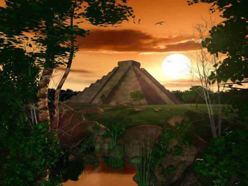
Most Ancient Mesoamerican civilisations built pyramid-shaped structures. These were also usually step pyramids, with temples on top - more akin to the ziggurats of Mesopotamia than to the pyramids of Ancient Egypt. The Mesoamerican region's largest pyramid by volume - indeed, the largest in the world by volume - is the Great Pyramid of Cholula, in the Mexican state of Puebla.
Most Ancient Mesoamerican civilizations built pyramid-shaped structures. These were also usually step pyramids, with temples on top - more akin to the ziggurats of Mesopotamia than to the pyramids of Ancient Egypt. The Mesoamerican region's largest pyramid by volume - indeed, the largest in the world by volume - is the Great Pyramid of Cholula, in the Mexican state of Puebla.
Pyramid of Cholula
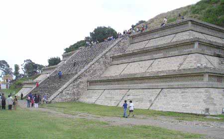
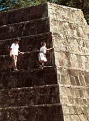
The Great Pyramid of Cholula or Tlachihualtepetl (Nahuatl for "artificial mountain") is a huge complex located in Cholula, Puebla, Mexico. It is the world's largest monument and largest Pre-Columbian pyramid by volume.
The temple-pyramid complex was built over many dozens of generations, from the 2nd century BC to the early 16th century, and was dedicated to the deity Quetzalcoatl. It has a base of 450 by 450 m (1476x1476 ft) and a height of 66 m (217 ft). According to the Guinness Book of Records, it is in fact the largest pyramid as well as the largest monument ever constructed anywhere in the world, with a total volume estimated at 4.45 million m, almost one third larger than that of the Great Pyramid of Giza in Egypt. The Aztecs believed that Xelhua built the Great Pyramid of Cholula.
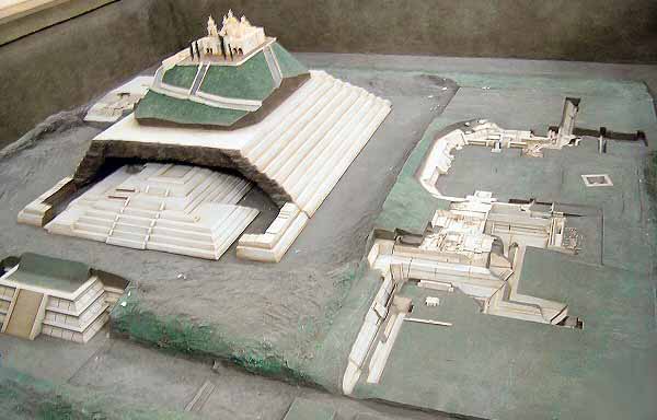
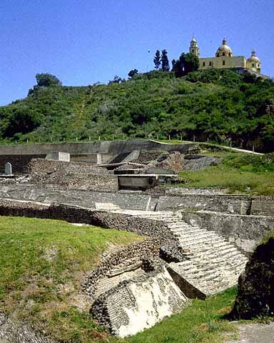
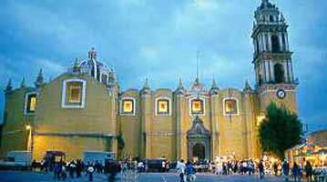
Today the pyramid at first appears to be a natural hill surmounted by a church. This is the Iglesia de Nuestra Señora de los Remedios (Church of Our Lady of the Remedies), also known as the Santuario de la Virgen de los Remedios (Sanctuary of the Virgin of the Remedies), which was built by the Spanish in colonial times (1594) on the site of a pre-Hispanic temple. The church is a major Catholic pilgrimage destination, and the site is also used for the celebration of indigenous rites. Many ancient sites in Latin America are found under modern Catholic holy sites, due to the practice of the Catholic Church repurposing local religious sites.
Because of the historic and religious significance of the church, which is a designated colonial monument, the pyramid as a whole has not been excavated and restored, as have the smaller but better-known pyramids at Teotihuacan. Inside the pyramid are some five miles (8 km) of tunnels excavated by archaeologists.
Aztecs
The Aztecs, a people with a rich mythology and cultural heritage, dominated central Mexico in the 14th, 15th and 16th centuries. Their capital was Tenochtitlan on the shore of Lake Texcoco - the site of modern-day Mexico City. They were linguistically related to, and culturally in awe of, the Toltecs, whose building styles they adopted and adapted.

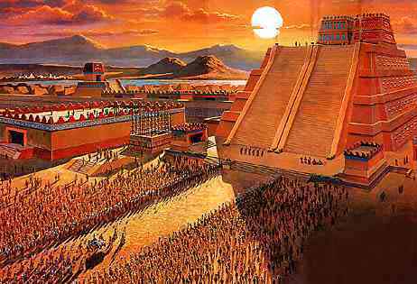
The Great Pyramid or Templo Mayor was the main temple of the Aztec capital of Tenochtitlan (modern Mexico City). The temple rose 60 m (197 ft) above the city's ritual precinct, surmounted by dual shrines to the deities Huitzilopochtli (god of war and sun) and Tlaloc (god of rain and fertility). It was mostly destroyed in 1521 after the conquest of the Aztec empire by the Spanish conquistadores under the leadership of Hernán Cortés. Remains of the lower portions of the temple complex have been discovered by modern archaeologists buried under a portion of modern Mexico City.
Numerous smaller buildings and platforms associated with the temple formed a closely-situated complex around its base. A stucco relief depicting a tzompantli, or "skull rack", decorated one platform leading to the temple. The temple was enlarged several times, and for the last time in 1487. The Great Temple was excavated between 1978 and 1987 in a major project directed by Eduardo Matos Moctezuma.
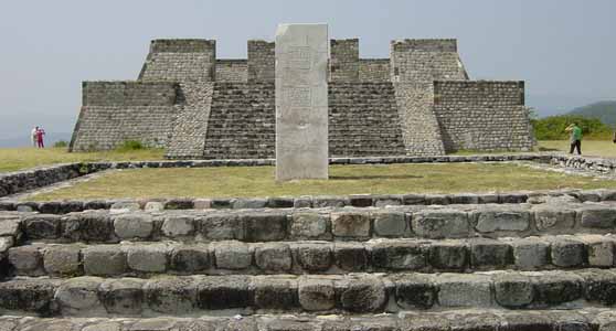
Xochicalco is a pre-Columbian archaeological site in the western part of the Mexican state of Morelos. The name "Xochicalco" means "in the house of Flowers" in the Nahuatl language. The site is located 38 km southwest of Cuernavaca, about 76 miles by road from Mexico City. The site is open to visitors all week, from 10am to 5pm, although access to the observatory is only allowed after noon. The apogee of Xochicalco came after the fall of Teotihuacán and it has been speculated that Xochicalco played a part in the fall of the Teotihuacano empire.
The architecture and iconography shows affinities with Teotihuacan, the Maya area, and the Matlatzinca culture of the Toluca Valley. Today some residents of the villages closest to the ruins of Xochicalco such as Cuentepec and Tetlama in eastern Morelos speak Nahuatl.
The main ceremonial center is atop an artificially leveled hill, with remains of residential structures, mostly unexcavated, on long terraces covering the slopes.
The site was occupied by 200 BC, with the most notable architecture built between about 700 and 1000 AD. At its peak, the city may have had a population of up to 20,000 people.
Of special interest are sculptured reliefs on the sides of some buildings. The Temple of the Feathered Serpent has fine stylized depictions of that deity in a style which includes apparent influences of Teotihuacan and Maya art. It has been speculated that Xochicalco may have had a community of artists from other parts of Mesoamerica.
Other monuments at the site include several other step-pyramid temples, palaces, three ballcourts, sweat-baths, an unusual row of circular altars, and a cave with steps carved down into it. The site also has some free-standing sculptured stelae; others were removed from their original location and are now on display in the INAH museum in Mexico City and at the site museum.
Modern history
The ruins were first described by explorer Antonio Alzate in 1777. Alexander von Humboldt published illustrations and a description of Xochicalco in 1810. Emperor Maximilian of Mexico visited the ruins. The Temple of the Feathered Serpent was restored by Mexican archaeologist Leopoldo Batres in 1910.
Major archaeological excavations and further restorations were done in a project from the 1940s through the 1960s by Eduardo Noguera and César Saenz. Jaime Litvak King also worked at the site. In 1976 archaeologist Kenneth Hirth of Pennsylvania State University began a multi-season fieldwork project in which he mapped the entire site and conducted excavations of houses and obsidian workshops.
In 1988 a large-scale program of excavation of monumental architecture was initiated by Norberto González Crespo and Silvia Garza of the INAH. A new museum was built to house the spectacular finds of this project.
Xochicalco is a UNESCO World Heritage Site and a tourist destination. The site also has a well-stocked museum.
Maya
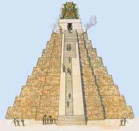
The Maya are a people of southern Mexico and northern Central America (Guatemala, Belize, western Honduras, and El Salvador) with some 3,000 years of history. Archaeological evidence shows the Maya started to build ceremonial architecture approximately 3,000 years ago. The earliest monuments consisted of simple burial mounds, the precursors to the spectacular stepped pyramids from the Terminal Pre-classic period and beyond. These pyramids relied on intricate carved stone in order to create a stair-stepped design. Many of these structures featured a top platform upon which a smaller dedicatory building was constructed, associated with a particular Maya deity. Maya pyramid-like structures were also erected to serve as a place of interment for powerful rulers. Maya pyramidic structures occur in a great variety of forms and functions, bounded by regional and period differences.
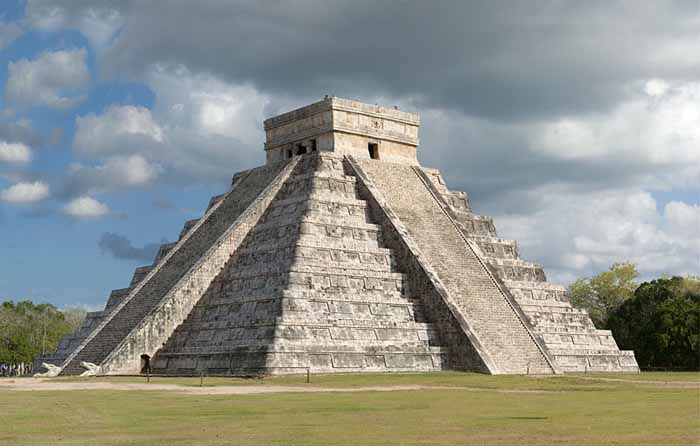
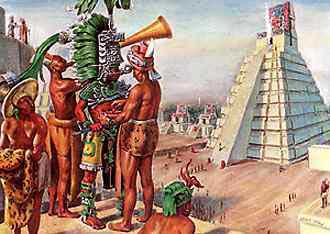
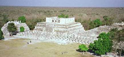
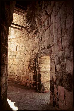
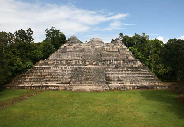
Chichen Itza is a large pre-Columbian archaeological site in Yucatan, Mexico built by the Maya civilization. The Maya name "Chich'en Itza" means "At the mouth of the well of the Itza (people)". Although this was the usual name for the site in pre-Columbian times, it is also referred to in the ancient chronicles as Uucyabnal, meaning "Seven Great Rulers". Chichen" contains many fine stone buildings in various states of preservation; the buildings were formerly used as temples, palaces, stages, markets, baths, and ballcourts.
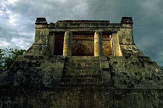
Mayan Pyramid of Kukulkan - The Castle
Mayan Pyramid of Kukulkan
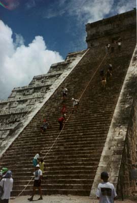
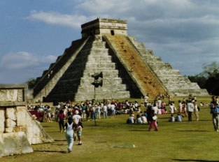
Dominating the center of Chichen is the Temple of Kukulcan (the Maya name for Quetzalcoatl), often referred to as El Castillo (the castle). This step pyramid with a ground plan of square terraces with stairways up each of the 4 sides to the temple on top.
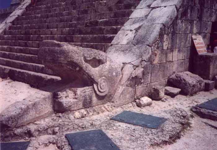
Great sculptures of Plumed Serpents run down the sides of the northern staircase, and are set off by shadows from the corner tiers on the Spring and Fall equinox. It was practice in Mesoamerican cities to periodically build larger and grander temple pyramids atop older ones, and this is one such example.
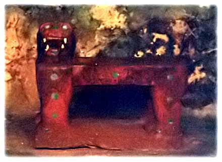
Thanks to archeologists, a doorway at the base of the north stairway leads to a tunnel, from which one can climb the steps of the earlier version of El Castillo inside the current one, up to the room on the top where you can see King Kukulcan's Jaguar Throne, carved of stone and painted red with jade spots.
Built into one of the exterior walls of the ballcourt is the Temple of the Jaguar, which features another jaguar throne since this one was not buried for a thousand years, its red paint and jade spots are long since gone. Behind this platform is a walled inscription which depicts a tzompantli (rack of impaled human skulls) in relief.
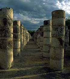
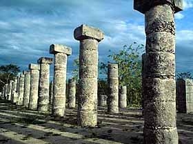
The 'Temple of the Warriors' and its adjacent 'Temple of the Jaguar' are very impressive ruins of the complex. A massive temple structure, surrounded by hundreds of columns is carved with reliefs. The columns continue on into the jungle, that part of the temple still has not been restored.
This celestial observatory denotes seasons based on solar alignment at different times of the year.
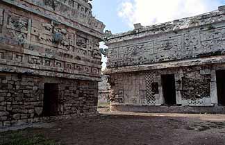
The Nunnery
The Mayans were great sportsmen and build huge ballcourts to play their games. The Great Ballcourt of Chichén Itzá is 545 feet long and 225 feet wide overall. It has no vault, no discontinuity between the walls and is totally open to the sky. As we approach a silent sentinel stands guard.
Ball Court Temple
Each end has a raised "temple" area. A whisper from end can be heard clearly at the other end 500 feet away and through the length and breath of the court. The sound waves are unaffected by wind direction or time of day/night. Archaeologists engaged in the reconstruction noted that the sound transmission became stronger and clearer as they proceeded. In 1931 Leopold Stokowski spent 4 days at the site to determine the acoustic principals that could be applied to an open-air concert theater he was designing. Stokowski failed to learn the secret. To this day it has not been explained.
of Kukulkan - Quetzalcoatl at Chichen Itza
The massive Kukulcan pyramid called 'El Castillo' - the castle - is roughly at the center of the site. Climbing it is quite a challenge and those who make it are rewarded with a spectacular view of the city and surrounding country side. Inside the pyramid, the corridors and chambers are hot and humid.
Handclaps evoke chirped echoes from the staircases of the Pyramid of Kukulkan at Chichen Itza. The physics of the chirped echo can be explained quite simply as periodic reflections from stepfaces. The chirped echo sounds much like the primary call of the Mayan sacred bird, the resplendent Quetzal.
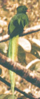
Quetzal Bird
This magnificent bird, now near extinction, has for thousands of years represented the 'spirit of the Maya'. Spirits, in many traditions, speak in echoes, lacking a body, just pure spirit.
A Mayan glyph from the Dresden Codex makes the connection between the pyramid of Kukulkan and the Quetzal bird. This glyph shows Kukulkan/Quetzalcoatl , the "sovereign plumed serpent" with a gigantic Quetzal behind him. The Quetzal bird may have represened the spirit of the Maya. Spirits often speak in echoes. It therefore seems most appropriate that the spirit echo of the Pyramid of Kukulkan would speak in the echo-voice of the Quetzal.
Today the Quetzal plays an important part in modern Mayan culture. Many modern Maya live in Guatemala, and in the Mexican States of Chiapas and Quintan Roo. The Quetzal is the unit of currency in Guatemala. The Guatemalan government issues a prestigious award named "The Order of the Quetzal." Could the Maya have intentionally coded the sound of their sacred bird into the pyramid architecture?
In the millenium since this pyramid was built, though the plaster has eroded from the limestone staircases, the sound is still recognizable.
Language of the Birds - God Language
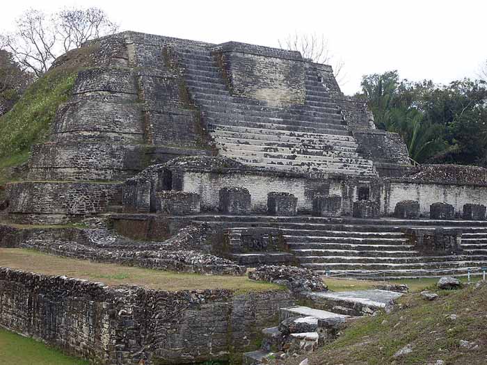
Altun Ha is the name given ruins of an ancient Maya city in Belize, located in the Belize District about 30 miles (50 km) north of Belize City and about 6 miles (10 km) west of the shore of the Caribbean Sea."Altun Ha" is a modern name in the Maya language, coined by translating the name of the nearby village of Rockstone Pond. The ancient name is at present unknown.The largest of Altun Ha's temple-pyramids, the "Temple of the Masonry Altars", is 54 feet (16 m) high. A drawing of this structure is the logo of Belize's leading brand of beer, "Belikin".
The site covers an area of about 5 miles (8 km) square. The central square mile of the site has remains of some 500 structures.Archeological investigations show that Altun Ha was occupied by 200 BC. The bulk of construction was from the Maya Classic era, c. 200 to 900 AD, when the site may have had a population of about 10,000 people. About 900 there was some looting of elite tombs of the site, which some think is suggestive of a revolt against the site's rulers.
The site remained populated for about another century after that, but with no new major ceremonial or elite architecture built during that time. After this the population dwindled, with a moderate surge of reoccupation in the 12th century before declining again to a small agricultural village.
The ruins of the ancient structures had their stones reused for residential construction of the agricultural village of Rockstone Pond in modern times, but the ancient site did not come to the attention of archeologists until 1963, when the existence of a sizable ancient site was recognized from the air by pilot and amateur Mayanist Hal Ball.
Starting in 1965 an archeological team lead by Dr. David Pendergast of the Royal Ontario Museum began extensive excavations and restorations of the site, which continued through 1970. One of the most spectacular discoveries is a large (almost 10 pounds or 5 kilograms) piece of jade elaborately carved into an image of the head of the Maya Sun God, Kinich Ahau. This jade head is considered one of the national treasures of Belize. A road connects Altun Ha to Belize's Northern Highway, and the site is accessible for tourism.
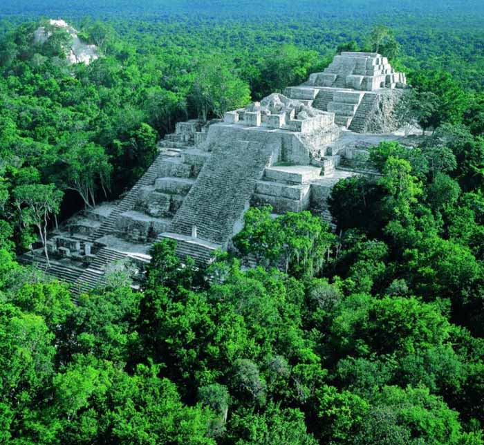
Calakmul is the name of both a municipality and a major archeological site in the Mexican state of Campeche, in the central part of the Yucatán Peninsula.
Calakmul (also Kalakmul and other less frequent variants) is also the name given to site of one of the largest ancient Maya cities ever uncovered. It is located in the 1,800,000 acre Calakmul Biosphere Reserve, deep in the jungles of the Petén, 30 km from the Guatemalan border.
First discovered from the air by biologist Cyrus L. Lundell of the Mexican Exploitation Chicle Company on December 29, 1931, the find was reported to Sylvanus G. Morley of the Carnegie Institute at Chichen Itza in March 1932. According to Lundell, who named the site, "In Maya, 'ca' means 'two', 'lak' means 'adjacent', and 'mul' signifies any artificial mound or pyramid, so 'Calakmul' is the 'City of the Two Adjacent Pyramids'."
Calakmul was the major seat of power of the Kaan or "Kingdom of the Snake", which first arose further north but built Calakmul into a Late Classic Era superpower ally of Caracol and rival to Tikal. A series of 11 painted vessels, dubbed Dynastic Vases, describe the ascensions of the Kaan rulers, including ancestral and legendary figures.
Calakmul probably supported a population of over 50,000, and so far more than 6,250 structures have been discovered in an area of up to 70 square kilometers with a substantial northern wall and a series of water management features (Calakmul's reservoirs include the largest in the Maya world) delineating a dense core of 22 square kilometers. Calakmul's 45 meter pyramid "Structure 2" is the largest Classic Era Maya temple platform known. Many of the city's monuments and structures are constructed of chalky local limestone, which has made interpretation of the site difficult.
After a long period of inactivity following Morely's 1932 expedition, the city was explored by William Folan between 1984 and 1994, and is now the subject of a large-scale project of the National Institute of Anthropology and History (INAH) under Ramon Carrasco.
Caracol or El Caracol is the name given to a large ancient Maya site located in the Cayo District of the nation of Belize. Caracol is about 25 miles south of Xunantunich and San Ignacio Cayo, at an elevation of 1500 feet (460 m) above sea-level, in the foothills of the Maya Mountains. The name is Spanish for "The Snail"; the ancient Maya name may have been Oxhuitza. It is known as such due to the large numbers of these creatures found at the site on its visitation by A.H. Anderson, the then chief archaeologist to British Honduras, after its discovery in 1937 by Rosa Mai, a mahogany logger. The site was occupied as early as 1200 BCE, but had its greatest period of construction in the Maya Classic period, with over 40 monuments dated between 485CE to 889CE which record the dynastic sequence of the rulers.
Ancient Caracol was one of the largest ancient Maya cities, covering some 65 square miles (168 kms) with an estimated peak population of about 120,000, or possibly as many as 180,000 people. One monument here records a military victory over the army of Tikal in 562CE, where Caracol's Lord Water is shown to have captured and sacrificed Tikal's Double Bird. This event is seemingly concurrent with archaeological and epigraphic evidence indicating the beginning of the Tikal Mid-Classic Hiatus, when a seeming decline in Tikal's population, a cessation of monument building, and the destruction of certain monuments in the Great Plaza occurred as Caracol's population and urban development seemingly skyrocketed.
The site was first noted and documented in archaeological terms in 1937. More extensive explorations and documention of the site was undertaken by the University of Pennsylvania in 1951 and 1953. A project of archaeological excavations and restorations of the ancient structures at Caracol started in 1985 and is ongoing. The project is currently directed by Drs. Arlen and Diane Chase of the University of Central Florida in Orlando. The site is maintained by residential wardens from the Belize Institute of Archaeology, a sub-division of the National Institute of Culture and History, a government-run agency.
The site currently accommodates an average of 15-20 tourists per day, with greater numbers during the peak season around Easter. A museum to hold the large monuments found at the site is currently being constructed. A visitor center is already at the site, and recent developments include new directional and informational signs and a house for the residential staff. The only road Caracol may be accessed by is paved for the last ten miles and leads to the Western Highway between San Ignacio and Belmopan and to Santa Elena.
Caana ("sky-palace") is the largest building at Caracol. It remains one of the largest man-made structures in Belize.
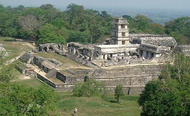
Palenque is a Maya archeological site near the Usumacinta River in the Mexican state of Chiapas. It is a medium-sized site, much smaller than such huge sites as Tikal or Copán, but it contains some of the finest architecture, sculpture, roof comb and bas-relief carvings the Maya produced.
The site was already long abandoned when the Spanish arrived in Chiapas. The first European to visit the ruins and publish an account was Father Pedro Lorenzo de la Nada in 1567; at the time the local Chol Maya called it Otolum meaning "Land with strong houses", de la Nada roughly translated this into Spanish to give the site the name "Palenque", meaning "fortification". Palenque also became the name for the town (Santo Domingo del Palenque) which was built over some peripheral ruins down in the valley from the main ceremonial center of the ancient city.
An ancient name for the city was Lakam Ha, which translates as "Big Water" or "Wide Water", for the numerous springs and wide cascades that are found within the site. Palenque was the capital of the important classic-age Mayan city-state of B'aakal (Bone).
The Maya Classic City
While the site was occupied by the middle Pre-Classic, it did not gain importance until several hundred years later. By 600 the first of the famous structures now visible were being constructed. Situated in the western reaches of Maya territory, on the edge of the southern highlands, B'aakal was a large and vital center of Maya civilization from the 5th century AD to the 9th century.
The B'aakal state had a chequered career. Its original dynasts were perhaps Olmec. Politically, the city experienced diverse fortunes, being disastrously defeated by Kalakmul in 599 and again in 611.
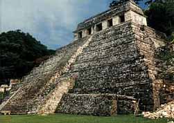
Nevertheless, B'aakal produced what is arguably the best-known Maya Ajaw (king or lord), Pacal the Great, who ruled from 615 to 683, and left one of the most magnificent tomb-works of ancient Mesoamerica, beneath the Temple of Inscriptions. This is a grand temple atop a step pyramid dedicated in 692; inside is an elaborate, long hieroglyphic text carved in stone detailing the city's ruling dynasty and the exploits of Pacal the Great.
A stone slab in the floor could be lifted up, revealing a passageway (filled in shortly before the city's abandonment and reopened by archeologists) to a long interior stairway leading back down to ground level and the shrine/tomb of the semi-divine Pacal. Over his crypt is an elaborate stone showing him falling into the underworld, and taking the guise of one of the Maya Hero Twins in the Popul Vuh who defeated the lords of the underworld to achieve immortality.
Other important structures at Palenque include:
- The Palace, actually a complex of several connected and adjacent buildings and courtyards built up over several generations on a wide artificial terrace. The Palace houses many fine sculptures and bas-relief carvings in addition to the distinctive four-story tower.
- The Temple of the Cross, Temple of the Sun, and Temple of the Foliated Cross. This is a set of graceful temples atop step pyramids, each with an elaborately carved relief in the inner chamber. They commemorate the succession of King Chan Bahlum II to the throne after the death of Pacal the Great, and show the late king passing on his greatness to his successor. These temples were named by early explorers; the cross-like images in two of the reliefs actually depict the tree of creation at the center of the world in Maya mythology.
- The Aqueduct constructed with great stone blocks with a three-meter-high vault to make the Otulum River flow underneath the floor of Palenque's main plaza.
- The Temple of The Lion at a distance of some 200 meters south of the main group of temples; its name came from the elaborate bas-relief carving of a king seated on a throne in the form of a jaguar.
- Structure XII with a bas-relief carving of the God of Death.
- Temple of the Count another elegant Classic Palenque temple, which got its name from the fact that early explorer Jean Frederic Waldeck lived in the building for some time, and Waldeck claimed to be a Count.
The site also has a number of other temples, tombs, and elite residences, some a good distance from the center of the site, a court for playing the Mesoamerican Ballgame, and an interesting stone bridge over the Otulum River some distance below the Aquaduct.
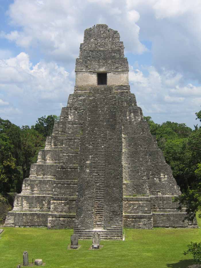
Tikal is the largest of the ancient ruined cities of the Maya civilization. It is located in the El Peten department of Guatemala. The ruins lay on lowland rainforest. Conspicuous trees at the Tikal park include gigantic ceiba (Ceiba pentandra) the sacred tree of the Maya; tropical cedar (Cedrela odorata), and mahogany (Swietenia). Regarding the fauna, agouti, spider monkeys, howler monkeys, ocellated turkeys, guans, toucans, green parrots and leaf-cutting ants can be seen there regularly. Jaguars and coatis are said to roam in the park.
Tikal was one of the major cultural and population centers of the Maya civilization. Monumental architecture was built here as early as the 4th century BC. The city was at its height in the Maya Classic Period, approximately 200 AD to 850 AD, after which no new major monuments were built, some of the palaces of the elite were burned, and the population gradually declined until the site was abandoned by the end of the 10th century.
The name "Tikal" means "Place of Voices" or "Place of Tongues" in Maya, which may be an ancient name for the city, although the ancient hieroglyphs usually refer to it as Mutal or Yax Mutal, meaning "Green Bundle", and perhaps metaphorically "First Prophecy".
Scholars estimate that at its peak its population was between 100,000 -- 200,000.
The site presents hundreds of significant ancient buildings, only a fraction of which have been excavated in the decades of archeological work.
The most prominent surviving buildings include six very large step pyramids supporting temples on their tops. They were numbered geographically by early explorers. They were built during the city's height from the late 7th and early 9th century. Temple I was built around 695; Temple III in 810; The largest, Temple-pyramid IV, some 72 meters (230 feet) high, was dedicated in 720. Temple V is from about 750.
Temple VI was dedicated in 766.The ancient city also has the remains of royal palaces, in addition to a number of smaller pyramids, palaces, residences, and inscribed stone monuments. There is even a building which seemed to have been a jail, originally with wooden bars across the windows and doors. There are also several courts for playing the Mesoamerican ballgame.
The residential area of Tikal covers an estimated 60 square km (23 square miles), much of which has not yet been cleared or excavated.
Some of the pyramids of Tikal are over 60 meters high (200 feet).A huge set of earthworks has been discovered ringing Tikal with a 6 meter wide trench behind a rampart. Only some 9km of it has been mapped; it may have enclosed an area of some 125 km square.
Recently, a project exploring the earthworks has shown that the scale of the earthworks is highly variable and that in many places it is inconsequential as a defensive feature. In addition, some parts of the earthwork were integrated into a canal system. The earthwork of Tikal varies significantly in coverage from what was originally proposed and it is much more complex and multifaceted than originally thought.
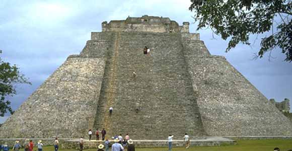
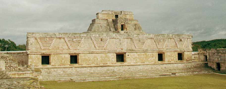
Uxmal is a large Pre-Columbian ruined city of the Maya civilization in the state of Yucatán, Mexico.
Uxmal is pronounced "Oosh-mahl". The place name is Pre-Columbian and it is usually assumed to be an archaic Maya language phrase meaning "Built Three Times", although some scholars of the Maya language dispute this derivation.
Even before the restoration work Uxmal was in better condition than many other Maya sites thanks to being unusually well built. Much was built with well cut stones not relying on plaster to hold the building together. The Maya architecture here is considered matched only by that of Palenque in elegance and beauty. The Puuc style of Maya architecture predominates. Thanks to its good state of preservation, it is one of the few Maya cities where the casual visitor can get a good idea of how the entire ceremonial center looked in ancient times.
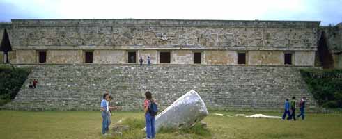
The Governor's Palace, a long low building atop a huge platform,
with the longest facades in Pre-Columbian Mesoamerica.
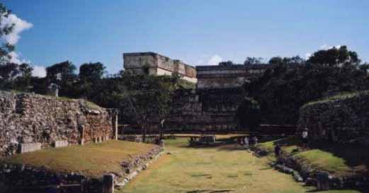
A large Ballcourt for playing the Mesoamerican ballgame, which an
inscription there informs us was dedicated in 901 by Chan Chak K'ak'nal-Ahau.
A number of other temple-pyramids, quadrangles, and other monuments, some of significant size, and in varying states of preservation, are also at Uxmal. The majority of hieroglyphic inscriptions were on a series of stone stelae unusually grouped together on a single platform. The stelae depict the ancient rulers of the city, and they show signs that they were deliberately broken and toppled in antiquity; some were re-erected and repaired.A further suggestion of possible war or battle is found in the remains of a wall which encircled most of the central ceremonial center. A large raised stone pedestrian causeway links Uxmal with the site of Kabah, some 18 km to the south.
Modern history of the ruins
The site, located not far from Mérida beside a road to Campeche, has attracted many visitors since the time of Mexico's independence. The first detailed account of the ruins was published by Jean Frederic Waldeck in 1838. John Lloyd Stephens and Frederick Catherwood made two extended visits to Uxmal in the early 1840s, with architect/draftsman Catherwood reportedly making so many plans and drawings that they could be used to construct a duplicate of the ancient city (unfortunately most of the drawings are lost).
Desire Charnay took a series of photographs of Uxmal in 1860. Some three years later Empress Carlota of Mexico visited Uxmal; in preparation for her visit local authorities had some statues and architectural elements depicting phallic themes removed from the ancient facades.
Sylvanus G. Morley made a map of the site in 1909 which included some previously overlooked buildings. The Mexican' governments first project to consolidate some of the structures from risk of collapse or further decay came in 1927.
In 1930 Frans Blom led a Tulane University expedition to the site which included making plaster casts of the façades of the "Nunnery Quadrangle"; using these casts a replica of the Quadrangle was constructed and displayed at the 1933 World's Fair in Chicago, Illinois.
In 1936 a further Mexican government repair and consolidation program was begun under José Erosa Peniche.
Queen Elizabeth II of the United Kingdom visited on 27 February of 1975 for the inaguration of the site's sound & light show; when the presentation reached the point where the sound system played the Maya prayer to Chaac, a sudden torrential downpour fell upon the gathered dignitaries, despite the fact that it was the middle of the dry season. Two hotels and a small museum have been built within the remains of the ancient city.
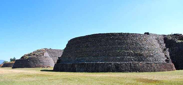
Tzintzuntzan is a city in the state of Michoacan, Mexico. It stands on the eastern shore of Lake Pátzcuaro, about 15 km north of the city of Patzcuaro and about 60 km west of state capital Morelia, and at some 2050 m above sea level. It serves as the administrative seat for the surrounding municipality of the same name and, in the 2000 census, reported a population of 3,610 people.
The city was founded in the 13th century by the Native American Tarascan or Purepecha nation, in whose language the name means "Place of the Hummingbirds".
The Pre-Columbian city of Tzintzuntzan covered an area of about 7 kms. The site, which stands on a hillside above the modern town, has the remains of many step pyramids of a design typically used by the P'urepecha in their ritual buildings, known locally as yacatas (by extension, the present-day archaeological site is also known as "Las Yácatas"). The Tzintzuntzan yácatas are of several different shapes, some rectangular, some oval or circular, and others in the distinctive Tarascan "T" shape. The population of the ancient city is estimated to have peaked at somewhere between 25,000 to 35,000 people.
The population of the entire Lake Patzcuaro basin was between 60,000 to 100,000, spread among 91 settlements of which Tzintzuntzan was the largest.
Tzintzuntzan was still the P'urhépecha capital when the Spaniards arrived in 1522. First contact, led by Nuno de Guzman arrived in 1529, Chieftain Tangaxuan II was burned alive and the city largely dismantled to provide stones for Roman Catholic temples and civic buildings, most notably the large 16th century Franciscan Monastery of Santa Ana. Following the disgrace and recall of Nuño de Guzmán, Vasco de Quiroga was sent to the region, and Tzintzuntzán served as the headquarters of Spanish power in the area until the bishopric was relocated to Pátzcuaro in 1540.
The modern town of Tzintzuntzan is known for the basketry and weaving produced there. The Monastery of Santa Ana is also still standing. It is home to several allegedly miraculous relics and icons and is reputed to have growing on its grounds what were the first olive trees to be planted in America.
Tzintzuntzan municipality covers a total of 165 kms. In addition to the municipal seat, the other main settlements are Ihuatzio, Cucuchuchu, and Los Corrales. In 1995, the municipality's total population numbered some 12,500, of whom 2550 spoke a Native American language (principally Purépecha and Ixcatec).
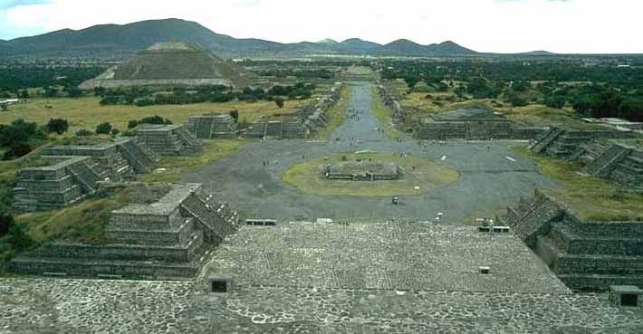
Comparative Geometric Analysis of the Heights and Bases of the Great Pyramid of Khufu and the Pyramid of the Sun at Teotihuacan ...
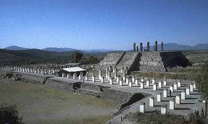
Tula is a town of 28,432 (2005 census) in the southwestern part of the state of Hidalgo in central Mexico, some 100 km to the north-northwest of Mexico City. The modern town is known as Tula de Allende; also a state municipality that covers part of the southeastern portion of the Pre-Columbian city. The present-day municipality has a population of 93,296 and an areal extent of 305.8 kms (118.07 sq mi), which includes numerous smaller outlying towns, the largest of which are El Llano, San Marcos, and San Miguel Vindho.
Nearby are the remains of the ancient capital city of the Toltecs, also known as "Tula" or as "Tollan". Usually identified as the Toltec capital around 980 CE, the city was destroyed at some time between 1168 or 1179.
The site is at and around the junction of two rivers, the Río Rosas and the Río Tula. The two largest clusters of grand ceremonial architecture are nicknamed "Tula Grande" (the most visited by tourists) and "Tula Chico". Remains of other buildings extend for some distance in all directions. In the residential areas streets were laid out in a grid pattern.
The city was the largest in central Mexico in the 9th and 10th centuries, covering an area of some 12 kms with a population of at least some 30,000, possibly significantly more. While it might have been the largest city in Mesoamerica at the time, some Maya sites in the Yucatán may have rivaled its population during this period.
Distinctive Toltec features here include terraced pyramids, colonnaded buildings, and relief sculptures, including the characteristic chacmools, reclining figures that may have been avatars of the rain god, Tlaloc. There are two large courts for playing the Mesoamerican ballgame. Some of the architecture is similar to that at Chichen Itza.
The site was extensively looted in Aztec times, with much of the artwork and sculpture carted off. The first scholarly description of the ruins was made by Antonio García Cubas of the Mexican Society of Geography and History in 1873. The first archaeological excavations were conducted in the 1880s by French antiquarian Désiré Charnay. A twenty year archaeological project under Jorge Acosta of Mexico's National Institute of Anthropology and History (INAH) began in 1940. In the 1970s further excavations and restorations of some structures were conducted by INAH and the University of MissouriColumbia.
Parts of the site are open for tourist visits, and Tula has a small museum.
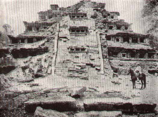
El Tajín is a Pre-Columbian archaeological site near the city of Papantla, in the state of Veracruz, Mexico.
Construction of ceremonial buildings at El Tajín began about the 1st century. Early classic Tajín shows influence of Teotihuacan; early postclassic shows considerable Toltec influence. Construction continued to about the start of the 13th century, at which time the city was conquered and burned by Chichimec invaders. The site continued to be occupied after this by a smaller population, but no new large construction projects were initiated. The site was completely abandoned with the arrival of the Spanish conquerors in the early 16th century.
The abandoned site was overgrown with forest. In 1785 engineer Diego Ruiz visited the site and published the first description of the site. In the early 19th century it was visited by Guillermo Dupaix, Alexander von Humboldt, and Carlos Nebel, who published additional accounts.The first archeological excavation of the site was made by Jose Garcia Payon from 1943 through 1963. The Mexican Institute of Anthropology & History has made additional restoration to buildings at the site since the 1980s.
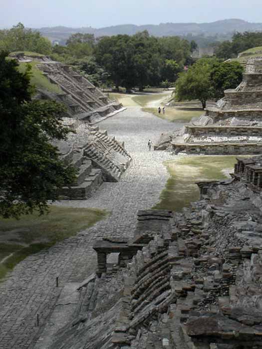
The ceremonial center of the site is covers only about 1 km square, but there are mostly unexcavated remains of subsidiary buildings extending for a considerable distance beyond.The ceremonial center has number of temple-pyramids, palaces, and several courts for playing the Mesoamerican ballgame.
The site's most famous building is the Pyramid of the Niches. The step pyramid of 6 terraces is some 60 feet high. The size is only medium as Mesoamerican pyramids go, but the architecture creates a striking and visually pleasing effect. The terraces are of well cut stone forming a series of 365 niches. A staircase rises up the pyramid's east side. Originally the pyramid was topped by a temple, but little remains of this.
A number of the buildings have carved relief on them, and the site also has some free standing stone stelae. Many of the sculptures depict the ritual ballgame and ritual bloodletting by the elite. The site is now a tourism destination, has a moderate sized museum.
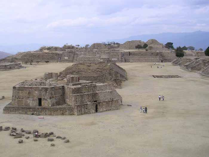
Monte Albán is a large archaeological site in the state of Oaxaca, Mexico, located at 17.02° N 96.45° W, elevation 1941 meters.The name "Monte Albán" means "White Mountain" in the Spanish language; the Zapotec name was Danipaguache, meaning "Sacred Mountain of Life".
The Aztecs knew it as Ocelotepec, or "Jaguar Mountain".
This sacred Mesoamerican city is on an artificially flattened mountain top some 400 meters above the city of Oaxaca.
Monte Albán was built over a period of over 2,000 years, starting about 900 BCE, by the Zapotec people. The early art shows Olmec influence. The most impressive building period was during the Mesoamerican Classic era, from about 550 CE to 1000 CE.
|About 1300 CE, the Zapotec were driven out of the site and surrounding area by the Mixtec people. The Mixtec made further additions to Monte Albán until they in turn were conquered by the Spanish Conquistadores in 1521, at which time Monte Albán was abandoned.
Monte Albán has many step-pyramids, temples, elite tombs, and a court for playing the Mesoamerican ballgame. There are also free-standing sculptured stelae, and large bas-relief carved panels in some of the buildings.
The oldest carved stones at the site are the so-called "Danzantes" (literally, dancers), featuring drawings of people in contorted and twisted poses. Although the notion that they depict a dance is generally discredited now, there is still little agreement on what exactly the figures represent, but many archaeologists think that the "dancers" are representations of tortured war prisoners. Some of the original stones can be viewed in the museum at the site.
Building J (the arrowhead-shaped building shown in the top picture) has also invited much speculation, due to its unusual shape and orientation. Alfonso Caso suggested it was an astrological observatory, though other theories have been offered.


1 comments:
My research on the Mesoamerican ballgame and it's connection with the god Quetzalcoatl and the planet Venus led me to your web page, and your link of Quetzalcoatl which both are very well done.
The Quetzalcoatl link, mentions that historian Enrique Florescano analyzing Teotihuacan iconography showed that the Feathered Serpent was part of a triad of agricultural deities: the Goddess of the Cave symbolizing motherhood, reproduction and life, Tlaloc, god of rain, lightning and thunder and the feathered serpent, god of vegetational renewal. The feathered serpent was furthermore connected to the star Venus because of this star's importance as a sign of the beginning of the rainy season. To both Teotihuacan and Mayan cultures Venus was in turn also symbolically connected with warfare.
Adding to that Enrique Florescano proposed long ago that the Maya Maize God, Hun Ahau, was a Maya version of Quetzalcoatl, the Plumed Serpent, who was worshiped as the planet Venus. According to stories recorded at the time of the Spanish Conquest, Quetzalcoatl created mankind and gave him fire and corn. Quetzalcoatl also invented the calendar and the rituals and feasts in which man would give sacrifice to the sacrificed sun in the underworld. Ballplayers were sacrificed in the underworld like the sun as the underworld jaguar and avatar of Quetzalcoatl. This was why Quetzalcoatl is depicted delivering sacred mushrooms to humanity (see page 24 Vindobonensis Codex at mushroomstone.com) so that his children could enter the spirit world give sacrifice to the gods and communicate with ancestor spirits deified in heavens.
Mesoamericans believed that when the sun moves across the sky it ages and than dies in the underworld, and that its a new-born Sun God, depicted in art as baby jaguar, that is reborn from ritual decapitation in the underworld, that rises each morning resurrected and lifted into the sky by an eagle the avatar of Quetzalcoatl.
The Quiche Maya authors of the Popol Vuh believed that a feathered serpent known as K’ucumatz, the Mayan name for Quetzalcoatl, carried the sun up to the sky and over the ocean and into the underworld. According to Susan Milbrath (1999, p.21) the Lacandon Maya believe that an underworld Venus god, known as Sucunyum, carries the sun on his shoulders in his journey through the underworld. “Each day the sun grows tired; he is transformed into a skeletal form at night and at dawn he is resurrected (McGee 1990:62-65, 116).
Believed to rise from the sacred center of the fourfold universe, where the first fire of creation was started was the Maize God, First Father, the Maya counterpart of Quetzalcoatl who in Maya creation accounts oversaw the new creation of the cosmos we now live in.
Carl de Borhegyi
(for more visit mushroomstone.com)
For a comprehensive treatment of the Ritual ball game, see Stephan F. de Borhegyi, 1980, The Pre-Columbian Ballgame: A Pan-Mesoamerican Tradition.
Post a Comment